| Title of Project/Resource | Airborne geophysical method images fast paths for managed recharge of California’s groundwater |
|---|---|
| Resource Author(s) |
|
| Link to Report/Website | iop.org |
| Full Description Text Body | Given the substantial groundwater level declines in the Central Valley of California, there is an urgent need to supplement the recharge of the groundwater systems by implementing managed aquifer recharge. With approximately 170 km3 (140 million acre-feet) of available groundwater storage space, water deemed to be excess during wet years could be spread on the ground surface at selected locations allowing it to move downward to recharge the underlying aquifer system. Along the eastern edge of the Central Valley there are large paleovalleys that can act as fast paths expediting the downward movement of water. These paleovalleys, incised and then filled with coarse-grained materials—sand, gravel, cobbles—at the end of the last glacial period, are referred to as incised valley fill (IVF) deposits. An IVF deposit has been mapped at one location in the Kings River alluvial fan, with others proposed to exist in the fans of major rivers. If located, these deposits would be optimal sites for managed recharge. In this study, we assessed the use of a helicopter deployed geophysical method to efficiently locate IVF deposits throughout the Central Valley. We acquired 542 line-kilometers of airborne electromagnetic (AEM) data in the Kings River alluvial fan, with dense line-spacing over the Kings River IVF deposit which had been mapped as ∼2 km wide, extending over 20 km into the Central Valley, from the ground surface to a depth of 30 m. The IVF deposit was unambiguously imaged in the AEM data as an extensive linear feature that was more electrically resistive than the surrounding materials due to the high percentage of coarse-grained sediments. This study provides the evidence to support the rapid adoption of the AEM method to locate IVF deposits along the eastern edge of the Central Valley. These deposits provide valuable natural infrastructure for recharging California’s groundwater. |
| Featured Image for Display | 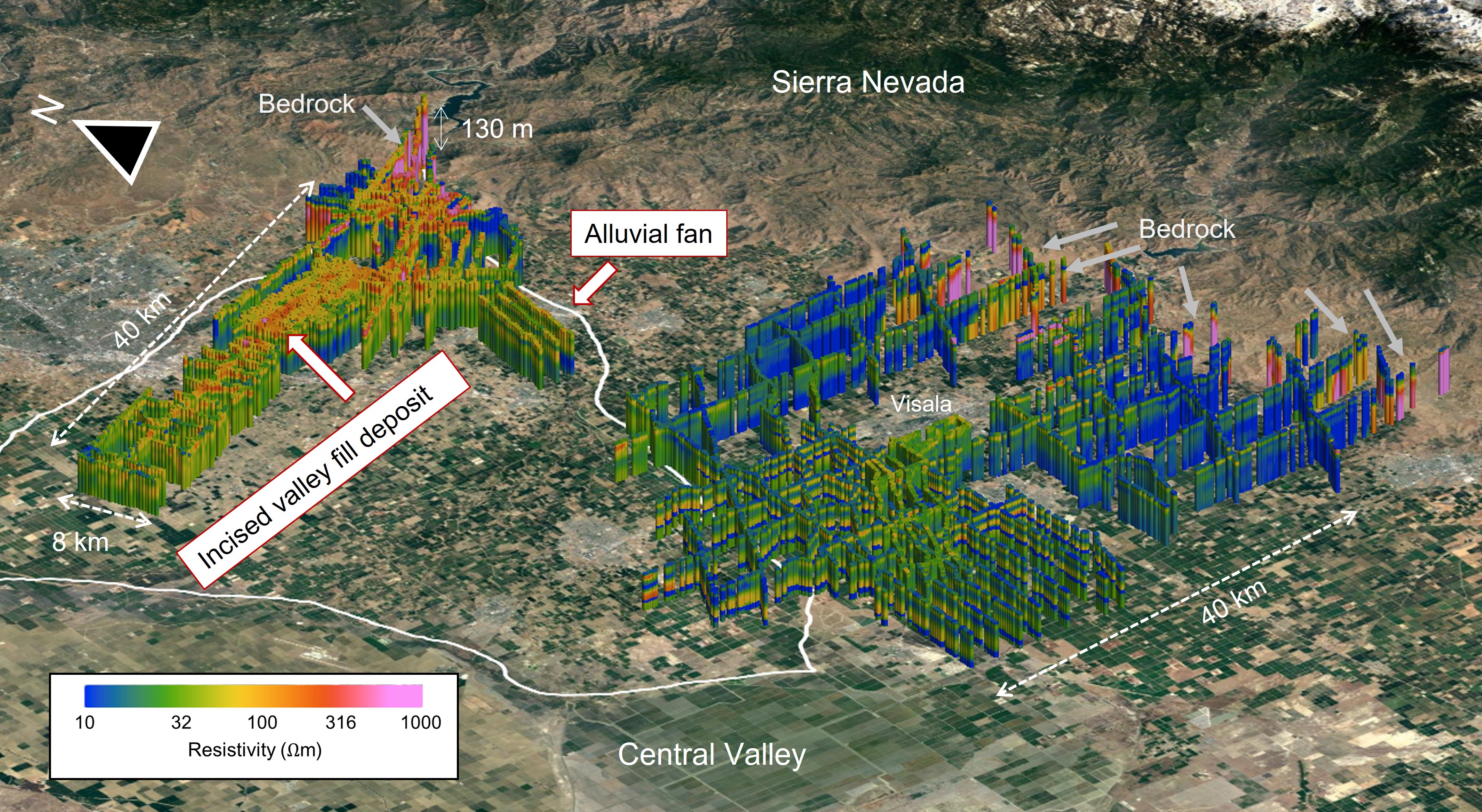 |
| Featured Image Credit | Knight et al., 2022 |
| Topic Area(s) |
|