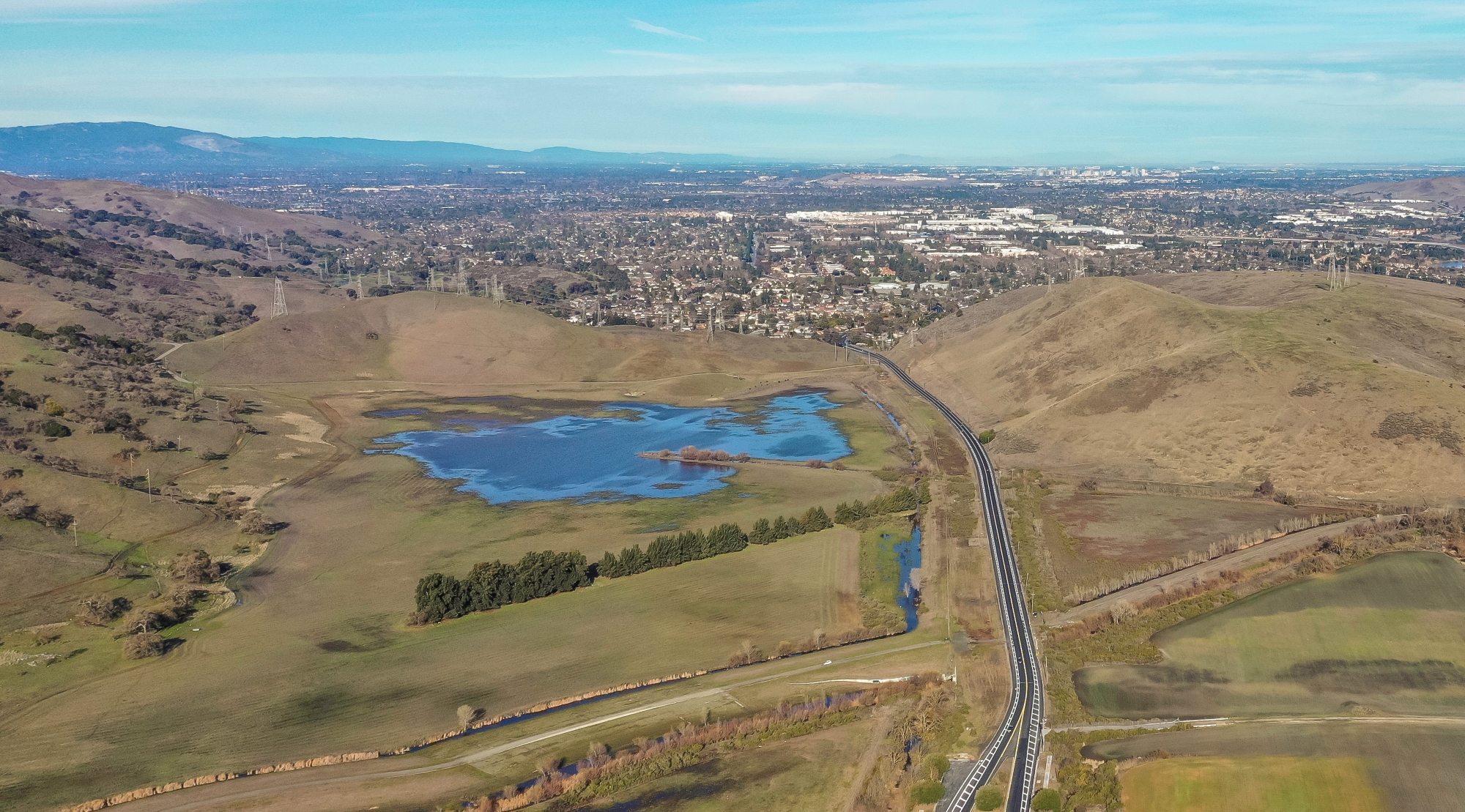
ABOUT COYOTE VALLEY
Coyote Valley is a rural and natural area located at the southern edge of San Jose and is one of the last remaining undeveloped valley floors in the region. Approximately seven miles long and two miles wide, it is defined by the Diablo Range to the east and the Santa Cruz Mountains to the west. The valley is remarkable for its role connecting the ecosystems of the Santa Cruz Mountains with the rest of California, as well as its scenic beauty, rich biodiversity, prime farmland
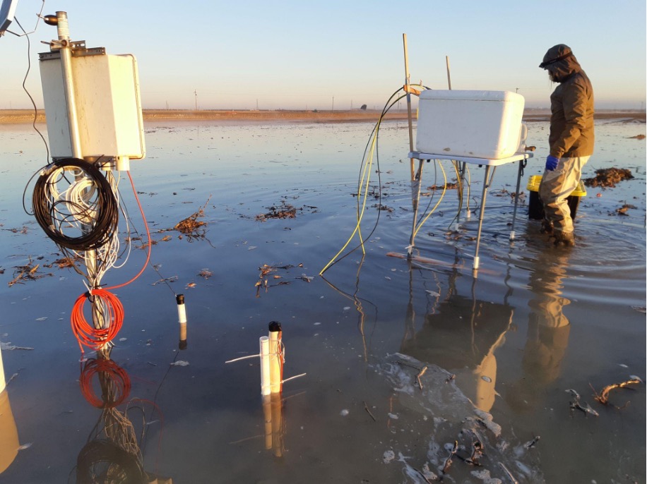
This project assesses pesticide residue leaching in response to agricultural groundwater recharge. To evaluate the risk of pesticide residue leaching, we 1) conducted a towed Transient ElectroMagnetic (towTEM) geophysical survey; 2) flooded an eight-acre section of a fallow field for eight days and monitored pesticide residue concentrations before, during, and after the recharge experiment; 3) performed a potassium bromide tracer test; and 4) are developing a pesticide fate and transport model.

Stormwater is an important source of water supply for Orange County. The Orange County Water District (OCWD) has been capturing and recharging stormwater in the Santa Ana River channel since 1936. Since Prado Dam was constructed by the US Army Corps of Engineers (USACE) in 1941, OCWD and the USACE have worked together to maximize the capture of stormwater behind the dam.
Tulare Irrigation District winter irrigation activities doubled with the implementation of a groundwater allocation and tracking system.
The Fairmead Groundwater Resilience Project, led by the County of Madera and their nonprofit partners, is designing and developing a plan for implementing a groundwater resilience project involving groundwater recharge and/or land repurposing efforts within the severely disadvantaged community of Fairmead, to buffer this area from the water security impacts of climate-induced drought.
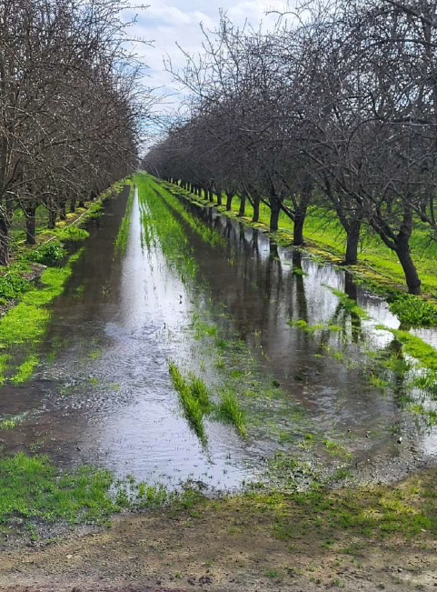
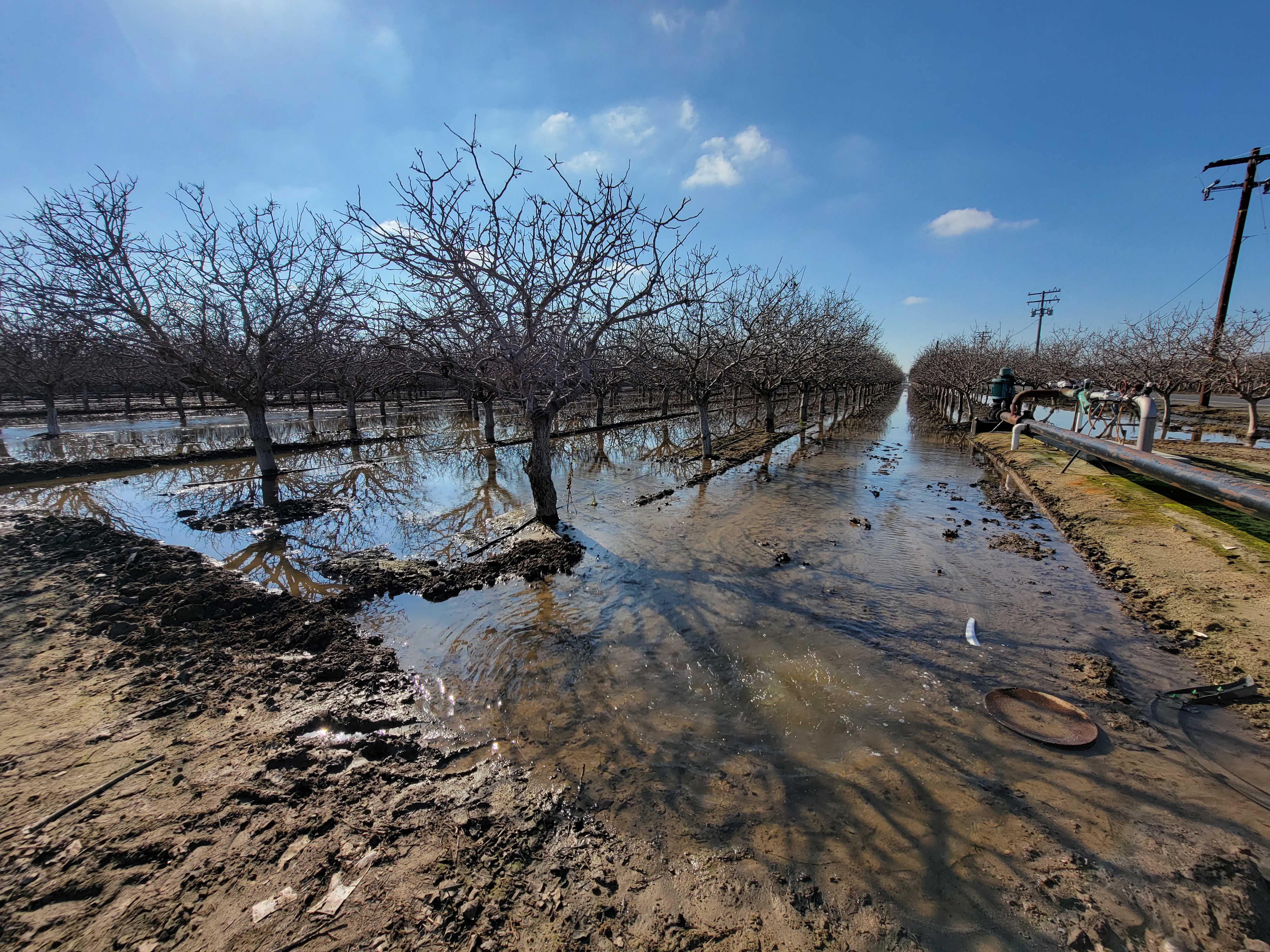
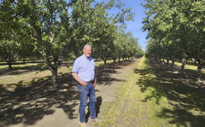
This Chowchilla-area grower tried on-farm recharge on his almond fields for the first time in 2023. This case study includes information on site conditions, water supply, soil health, on-farm recharge logistics, and recharge events.
Russel and Matt Efird grow raisins, almonds, walnuts, pistachios, and canning peaches in Fresno County, California. Groundwater levels on their farm have decreased 50 feet from 1992 through 2022. On-farm recharge can help to reverse groundwater overdrafting and cease land subsidence occurring in the subbasin.
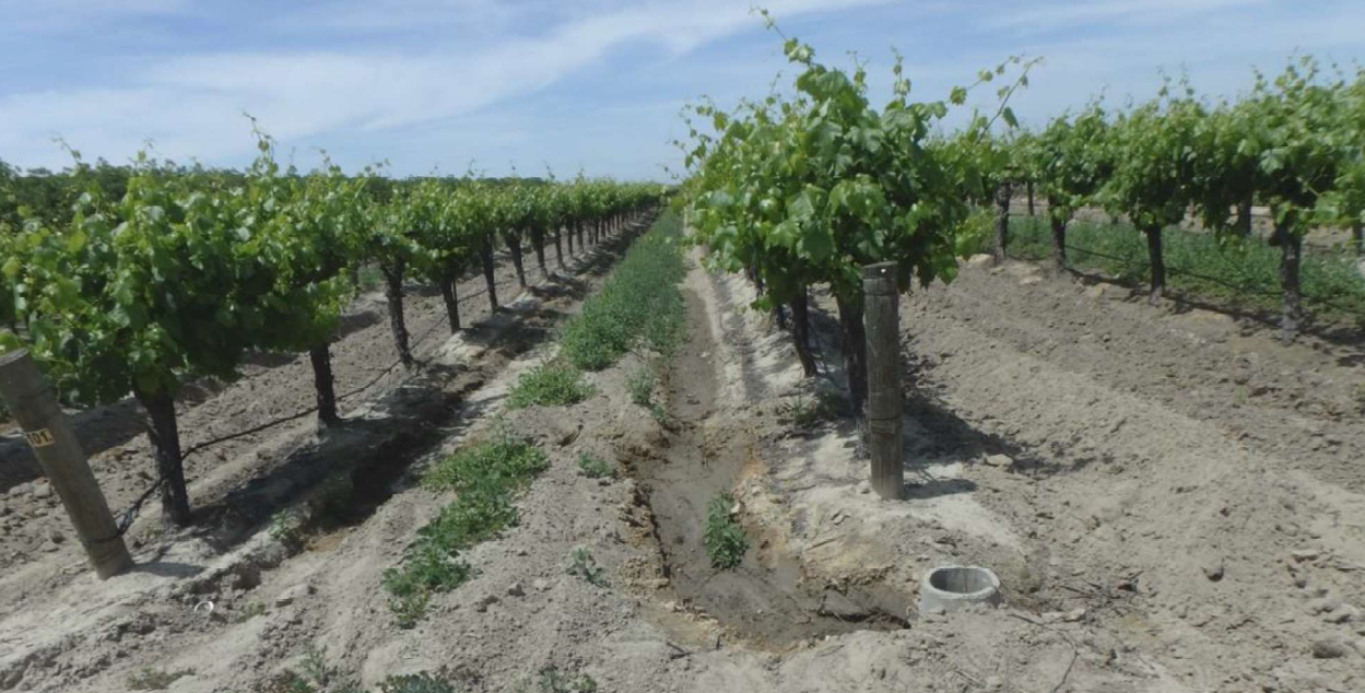
Al Costa is a wine grape grower in the San Joaquin County who has participated in on-farm recharge since 2018. His 13.7-acre recharge site is very sandy, allowing the application of large volumes of water without harm to his crops.

Three Turlock-area growers – Christine and Erich Gemperle, Eric Harcksen, and Eric Spycher – tried on-farm recharge on their almond orchards for the first time in 2023. These case studies include information on site conditions, water supply, soil health, on-farm recharge logistics, and recharge events.
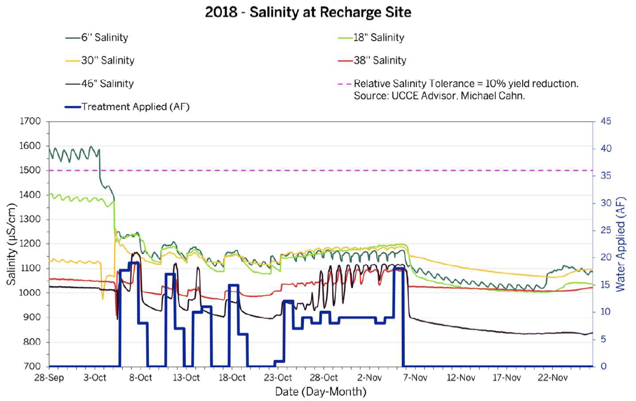
Arlan Thomas is an organic almond grower who was motivated to replenish
the overdrafted aquifer below his farm to save his well from drying up and to
prevent land subsidence. This farm was the subject of an in-depth study, On-Farm Flood Capture and Recharge at an Organic Almond Orchard, Recharge Rates and Soil Profile
Responses by Phil Bachand & Associates, Davis, California, and Tetra Tech,
Rancho Cordova, California (April 2017).
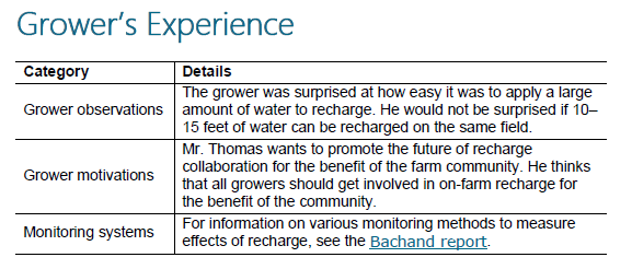
These two case studies – one on an almond orchard and the other on a wine grape vineyard – show how one grower adapts to different conditions and crops to achieve his recharge goals.
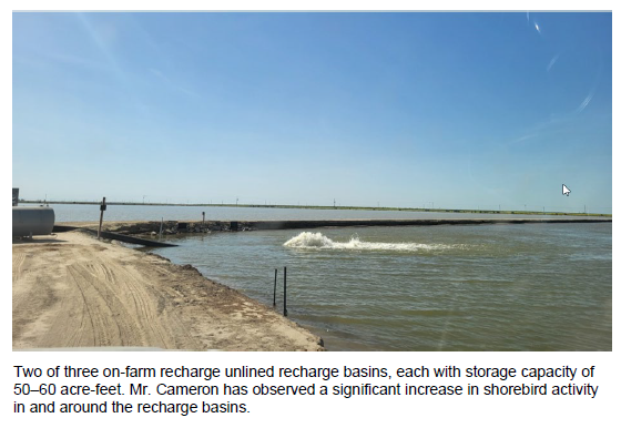
Don Cameron has been planning and building an on-farm recharge basin storage system for more than five years. The system is comprised of three on-farm recharge basins, each having a
capacity of 50–60 acre-feet of water storage. These basins are unlined, which allow them to function as recharge basins while also serving as storage sites from which to convey on-farm recharge water to surrounding fields.