| Title of Project/Resource | California DWR Airborne Electromagnetic Surveys |
|---|---|
| Resource Author(s) |
|
| Link to Report/Website | water.ca.gov |
| Full Description Text Body | The Department of Water Resources is conducting airborne electromagnetic (AEM) surveys in California’s high- and medium-priority groundwater basins, where data collection is feasible, to assist local water managers as they implement the Sustainable Groundwater Management Act (SGMA) to manage groundwater for long term sustainability. The AEM project provides state and federal agencies, groundwater sustainability agencies (GSAs), stakeholders, and the public with basin-specific and cross-basin geophysical data, tools, and analyses. The surveys are funded by voter-approved Proposition 68, Senate Bill 5, and from the general fund. More information can be found in the AEM Proposition 68 Fact Sheet. During an AEM survey, a helicopter tows electronic equipment that sends signals into the ground which bounce back. The process has been compared to taking an MRI of the ground’s subsurface. The data collected is used to create continuous images that are interpreted for underground geology. The resulting information will provide a standardized, statewide dataset that improves the understanding of aquifer structures. It can also help with the development or refinement of hydrogeologic conceptual models and can help identify areas for recharging groundwater. |
| Featured Image for Display | 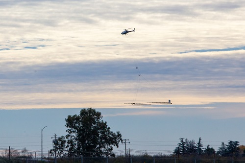 |
| Featured Image Credit | California Department of Water Resources |
| Resource Host Organization, Partner Organizations (Optional) |
|
| Topic Area(s) |
|