
The Department of Water Resources is conducting airborne electromagnetic (AEM) surveys in California’s high- and medium-priority groundwater basins, where data collection is feasible, to assist local water managers as they implement the Sustainable Groundwater Management Act (SGMA) to manage groundwater for long term sustainability.

The Soil Agricultural Groundwater Banking Index (SAGBI) is a suitability index for groundwater recharge on agricultural land. The SAGBI is based on five major factors that are critical to successful agricultural groundwater banking: deep percolation, root zone residence time, topography, chemical limitations, and soil surface condition.
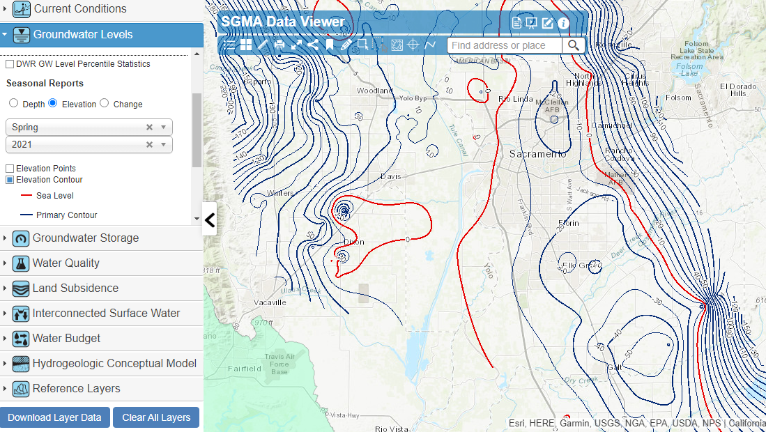
As part of DWR’s technical assistance to Groundwater Sustainability Agencies (GSAs), other water managers, and the public, DWR has developed the SGMA Data Viewer. The SGMA Data Viewer provides access to groundwater-related datasets that are organized by the requirements of SGMA and the Groundwater Sustainability Plan (GSP) regulations for the purposes of supporting GSP development and implementation.